
Farmers Branch Neighbors by Parcel
The first public answer around a Farmers Branch address is usually about land, not residency. The city’s EnerGov Display Map supplies site-address points, tax-parcel geometry, road centerlines, city limits, zoning, overlay, police-beat, code-enforcement, and council-district layers. The Farmers Branch map service exposes Identify and Query tools that make it possible to select the target polygon and the parcels that touch it. Use those parcel IDs and site addresses as a clean starting list, then resolve each one through the appraisal district.
| Block source | What it establishes | Access path |
|---|---|---|
| Farmers Branch GIS Tax Parcels | Touching parcel shapes, site addresses, roads and city line | Public Identify and Query service |
| DCAD range search | Properties on a numbered street segment and current assessed owners | Public address search |
| Dallas Official Records | Transfers and named parties for a legal description | Public index; copies through the clerk |
| Voter lookup or file request | Individual registration data or restricted file filters | State and county rules apply |
| Directory street guide | Historical household or business clues at an address | UNT, TSLAC, or library access |
Owners and occupants are not interchangeable. A DCAD mailing address can belong to an agent, a post-office box, a different property, or a former address. A parcel card is useful evidence about ownership, but it is not proof that every person at the property is a current neighbor.
Farmers Branch GIS Layers
The city service is more useful than a plain pin map because it separates physical questions around a block. Turn on Site Address Points, Tax Parcels, and Road Centerlines before selecting a parcel. City Limit helps when the far side of a street is under a different municipal custodian. Zoning, specific-use permits, overlays, police beats, code-enforcement districts, and council districts add civic geography, not a resident roster. The service documents Export Map, Find, Identify, Query, QueryLegends, and Return Updates, with a 6,000-record maximum.
For a broader parcel history, DCAD GIS products list current and historic parcels, dimensions, subdivision and block identifiers, survey abstracts, and governmental boundaries. Those downloads require GIS software and are approximate, not legal surveys. They are most helpful when an older lot line or subdivision name helps distinguish nearby records.
The city GIS service shows the local layers used for a Farmers Branch neighbors search.
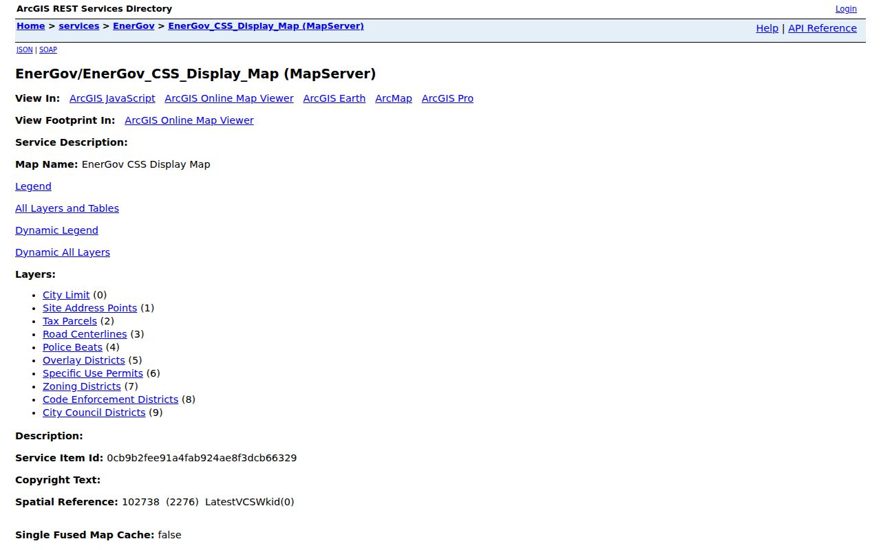
Use the parcel and road layers to establish adjacency first, then use a separate record source for any owner name or dated transfer.
Map a Farmers Branch Block
Use one address as the anchor, then preserve the three keys that connect local systems: the DCAD account number, the Dallas County legal description or instrument number, and the city parcel geometry. A legal description is the lot, block, subdivision, tract, or metes-and-bounds wording that identifies land. It often stays useful when a mailing label or street spelling does not.
- Search the address in DCAD eSearch and record the account number, situs address, legal description, and current owner.
- Open the city map service, activate Tax Parcels, Site Address Points, and Road Centerlines, then select the target parcel with Identify.
- Select polygons that touch the parcel or sit immediately across the road. Note the site address and parcel identifier for each.
- Open each address in DCAD separately. Compare owner, situs, mailing address, legal description, and exemption context without treating an exemption as a household list.
- Use the legal description in the Dallas County Official Records search when a dated ownership transfer needs confirmation.
The method stays focused on an immediate block. For a longer address-by-address chain along a named road, use the Farmers Branch street directory rather than turning a neighbors search into a whole-street roster.
Farmers Branch Neighbor Boundaries
On a dense Dallas-area block, geography can shift at a road, alley, drainage feature, or city line. The map service’s City Limit and Road Centerlines layers help separate same-side parcels from parcels that are close but not truly adjacent. A postal city can differ from the municipality, and DCAD’s situs and mailing fields serve different purposes. Keep all four labels when the records disagree rather than overwriting one with another.
A target parcel may be in Farmers Branch municipal jurisdiction, part of Dallas County appraisal and court geography, and associated with a Dallas postal label. The map and the appraisal card answer different questions, so neither should be treated as a universal address authority.
Note: Parcel boundaries are useful research guides, but they do not replace a survey, title examination, or the custodian’s certified record.
Voter Limits for Farmers Branch Neighbors
Texas offers a person-specific registration path through the state Am I Registered? service and the Dallas County voter-status entry point. The state guide uses name, county, date of birth, and ZIP. It is not a street-wide web roster. A result may supply status, VUID, polling-place, precinct, or district information, but it never reveals how anyone voted.
A statewide voter-file request has a separate route: its filters can include county, precinct, status, participation, date, and other fields, but require an affidavit, requester contact information, deposit, and payment. Texas Election Code limits sensitive fields and protected residences. Treat a missing result as an access rule or date issue, never as proof that a person did not live on the block.
Farmers Branch Community Paths
The available community layer is narrower than a neighborhood household directory. A city Residential Communities asset appeared in official search results, but its names and publication date were not exposed in the research, so it should be verified before reliance. City boards, commission pages, agendas, and the Council district map are better official civic-roster paths than guessing a private association from an address.
Farmers Branch Chamber
The Chamber member directory offers keyword, category, and alphabetical browsing. Its Family and Community & Civic Organization categories can identify organizations, not household members. Contact: 972-243-8966, info@farmersbranchchamber.org.
Local history layer
Carrollton–Farmers Branch TXGenWeb indexes cemeteries, phone books, schools, old homes, maps, and land-grant material. Check the original repository before treating an index entry as proof.
Private congregation, block-watch, and civic-club rosters were not located as openly published Farmers Branch lists. Ask the Manske Library, Historical Park resources, or the Chamber about a specific public organization instead of collecting private member details.
Historic Farmers Branch Neighbors
For an older block, a directory street guide can connect an address to a household or business in a particular year. TSLAC’s Dallas directory run spans 1875 through 1991 with gaps, and UNT provides digitized volumes with OCR and page images. Geographic scope must be checked volume by volume. A 1961 Dallas directory contains a Farmers Branch Chamber entry, while a 1955 volume identifies Dallas, Highland Park, and University Park in its introduction.
Use a street guide as a dated lead. Pair it with the year’s alphabetic entries, deed chain, probate or obituary records, and released census schedules. Older Farmers Branch references may use Peters Colony, Mustang Branch, Webb’s Chapel, or railroad geography rather than a modern municipal label. That local history is a reason to vary search terms, not a reason to infer a modern household connection.
Official Records and Neighbor Tools
Official sources and commercial neighbor-lookup tools do different jobs. The official route keeps the original custodian and a clear date: city geometry for adjacency, DCAD for the appraisal owner, the clerk’s index for transfers, and library collections for historical addresses. Commercial tools can combine property, directory, and purchased data, but can also merge adjacent owners, retain stale addresses, or point to the wrong person.
| Official record trail | Shows the source, date, and scope. It requires comparing records and respecting access limits. |
|---|---|
| Commercial category | Can be convenient, but does not establish present occupancy or replace a custodian record. |
For a possible error, return to the office that holds the record. DCAD, Dallas County Elections, the County Clerk, and the relevant city department can explain correction or request paths.
Private Limits Around Farmers Branch
Many facts about a block are not public. Renters and other household members are not guaranteed by parcel records. Utility, delivery, and Texas motor-vehicle addresses are not general public rolls. Sealed, juvenile, adoption, and protected-voter information is restricted. Eligible officials and qualifying protected people can use Texas address-confidentiality procedures, so a public-facing record may properly omit a residence.
Lawful use. Farmers Branch neighbors research is for personal, lawful purposes such as understanding property records, reconnecting appropriately, or civic curiosity. Do not use any result to watch, stalk, harass, intimidate, or harm another person.
The Texas voter confidentiality guidance explains protected-address procedures. For privacy complaints involving commercial data, preserve the source, date, and confirmation and use the appropriate Texas Attorney General consumer-protection route.