
Walking a Farmers Branch Street Directory Search
The local street directory trail is parcel-first. A street name by itself can be ambiguous across Dallas County. A number, street name, and city can lead to DCAD; the DCAD account then links the current appraisal record to a legal description. That description is often more stable than an address because it can survive a changed street label, parcel split, condominium conversion, or postal-city difference.
- Enter the target address in DCAD and note the account, situs address, owner, mailing address, subdivision, block, lot, or other legal description.
- Open the city GIS service and use Site Address Points, Tax Parcels, and Road Centerlines to place that parcel on the street segment.
- Search the current owner as grantee in Dallas Official Records. Use the legal description, subdivision, document type, and recorded date as backup keys.
- Read the deed and search the seller as the next grantee to extend the dated ownership trail backward.
- For a past address clue, consult Dallas directory street or avenue guides, then compare the year and geographic coverage.
A voter lookup has a different role. Texas and Dallas County public routes are person-specific and use name, county, date of birth, and ZIP. They are not public tools for listing a street’s households. City permit and code records are also address-keyed, but their online fields and coverage vary.
Farmers Branch Street Directory Fields at DCAD
DCAD eSearch has separate address, owner, business-name, and account-number modes. The address screen asks for Number and Street Name, with optional Direction, Building, Suite, City, From/To range, and account type. Street Name excludes the street type, requires at least two characters, rejects spaces, and supports a percent-sign wildcard. Search a short form first, then refine it with city or range values.
| Search field | Required | How it helps a street search |
|---|---|---|
| Number | Yes | Finds a single numeric address |
| Street Name | Yes | Enter the core name without street type or spaces |
| Direction | No | Separates directional variants when exposed |
| Building / Suite | No | Narrows multi-unit location detail |
| City | No | Choose Farmers Branch when listed |
| From / To | Conditional | Browses one numbered street segment |
| Account Type | No | Residential, commercial, or BPP accounts |
Owner search requires a last name and can use a first name. It supports partial last-name searching and the percent wildcard. A name such as McDonald can be indexed as “Mc Donald,” so a property result should be confirmed by its address, account, and legal description rather than name alone.
Farmers Branch Street Directory Address Labels
A DCAD parcel card separates situs and mailing addresses. The situs is the physical property location. The mailing address is where appraisal notices are sent. They may match, but a different mailing address can belong to an owner’s other location, an agent, a P.O. box, or an old address. It is therefore a useful contact clue, not confirmation that a person is present at the parcel.
- Parcel
- A mapped unit of property used by the appraisal system, normally linked to an account number.
- Situs address
- The street address where the parcel is located.
- Plat
- A recorded map that can show a subdivision, lots, blocks, and streets.
- Criss-cross directory
- A directory section arranged by address or street, used to find an historical occupant or business after the address is known.
DCAD does not assign property addresses. Farmers Branch assigns municipal addresses, while DCAD can change a mailing address. When a street search fails, preserve the legal description exactly and use it with the County Clerk’s index or a plat rather than guessing that the street was renumbered. Research did not locate an official local renumbering year.
Farmers Branch Street Directory Map Layers
The Farmers Branch GIS MapServer offers City Limit, Site Address Points, Tax Parcels, Road Centerlines, Police Beats, Overlay Districts, Specific Use Permits, Zoning Districts, Code Enforcement Districts, and City Council Districts. Its documented service operations include Identify, Query, Find, QueryLegends, Return Updates, and Export Map. Those layers put a DCAD account into street and municipal context.
To inspect a segment, identify the target parcel, then click or query the immediately bordering parcel polygons. Road Centerlines help distinguish the same side of a road from an across-street parcel. The city service documents Identify and Query, not a consumer-facing radius or buffer search. Pair a map result with the individual DCAD account instead of inferring a current occupant from a polygon.
DCAD GIS products add current and historical parcel geometry, dimensions, parcel IDs, subdivisions, survey abstracts, land grants, and jurisdiction boundaries. The data require GIS software and are approximate, not legal surveys.
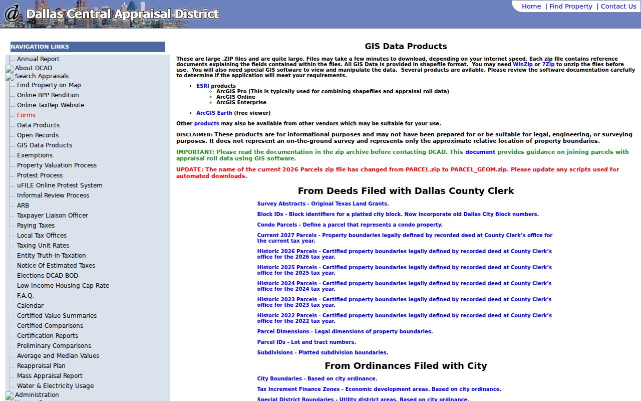
Historic product years listed by DCAD run from 2022 through 2027, while the parcel card is the route for current account details.
Farmers Branch Street Directory Deed Trails
Dallas County Official Records connects a street lead to recorded parties. The Property Records search accepts a grantor or grantee, subdivision, document type, or document number, plus recorded-date ranges. It offers Index Only and Index & Full Text OCR scopes. Use an owner name as a grantee and retain the subdivision or legal description in case a name has a trust, estate, corporate, or spelling variant.
Open an image when one is available and record the instrument number, document type, parties, recorded date, volume or page if displayed, and legal description. Then look for the seller’s earlier acquisition as a grantee. A deed, release of lien, plat, or transfer can be relevant to the chain, but an instrument party is not automatically a resident. The portal does not publish an earliest complete online cutoff year.
The screenshot from Dallas Official Records shows the official search choices used for the street-to-deed handoff.
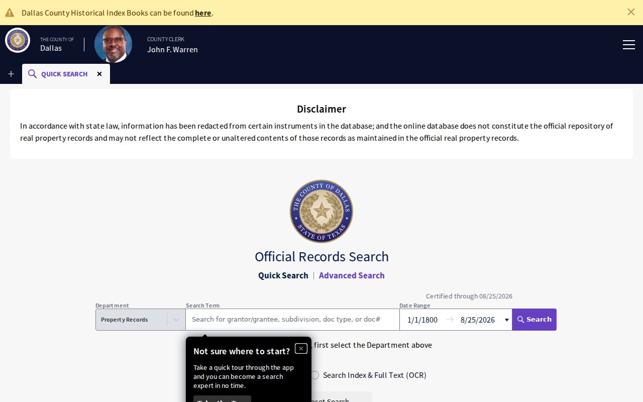
For older work, FamilySearch lists Dallas deed indexes from 1846 to 1970 and deeds from 1846 to 1901. TSLAC microfilm and the clerk counter remain alternatives when the online route stops.
Farmers Branch Street Directory Permit Evidence
City permit and code material can date work at an address. Farmers Branch Citizen Self Service requires registration with an email, and the inspected route had a JavaScript and cookie requirement. The city’s current route can connect an account or address to permit or inspection material, with applicant, contractor, or owner fields when public. Its exact historic coverage was not located.
An inspected Laserfiche permit model showed a permit number, project address and date, description, type, DCAD number, legal description, applicant or contractor, owner, license, valuation, and inspection fields. It is a field model, not a current parcel record. If a record is not visible, request it through the city’s public-information route with an address, permit number, department, and date range.
The Farmers Branch Public Information Request Portal offers submission, status tracking, and download actions for city requests.
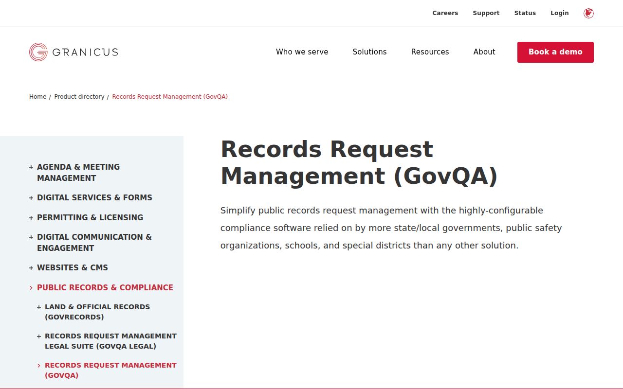
A written request is the fallback when a current city record has no exposed public search field or no stated online coverage year.
Farmers Branch Street Directory Record Coverage
Address-keyed sources reveal different parts of a street history. Use the address or parcel to locate a current account, then shift to the legal description and parties when tracing recorded ownership. Historical directories work by street guide and year. They can add occupants or businesses, but their scope can be Dallas-wide rather than a complete Farmers Branch run.
| Address record | What it shows | Keeper | Access |
|---|---|---|---|
| Appraisal account | Owner, situs, mailing address, legal description | DCAD | Public eSearch and open-record route |
| GIS parcel | Parcel geometry, site point, roads, districts | Farmers Branch / DCAD | Map Identify and Query |
| Official deed index | Grantor, grantee, date, document, legal description | Dallas County Clerk | Portal, e-certify, counter, or mail |
| Permit record | Project address and public project fields | Farmers Branch | Self Service or written request |
| Directory street guide | Historical address, occupant or business details | TSLAC, UNT, Manske | On-site, digitized, or library access |
Tax data, voter records, and code cases have their own access rules. The street name alone does not tie all sets together. The parcel account and legal description are the practical bridge between appraisal, GIS, permits, plats, and deeds.
Farmers Branch Street Directory History
Dallas directories offer a historical street tool through their street and avenue guides. TSLAC lists Dallas directories from 1875 through 1991 with gaps, and UNT makes selected page images searchable. First search the alphabetical household or business section, then turn to the street guide. A name missing from the alphabetical section may appear in a business, apartment, institution, or classified entry.
A directory listing can contain an address, telephone, spouse, occupation, and owner or renter mark. Geographic scope must be checked. Farmers Branch appears inside Greater Dallas and Dallas directory systems, so a Dallas volume is not proof that every Farmers Branch address was included. The collection and entry-reading details are available on the Farmers Branch city directory page.
Compare adjacent years rather than assuming annual publication. A missing entry may reflect a skipped volume, changed coverage, rural geography, or OCR error. Search old telephone exchanges, street suffixes, and known initials as variants.
Farmers Branch Street Directory Voter Limits
Texas voter lookup is built to confirm a person’s registration with name, county, date of birth, and ZIP. It is not an open tool for running an address range or a street-wide list. A statewide voter-file request can filter for selected counties, precincts, status, effective date range, age range, or election participation, but it requires a specified request, notarized affidavit, deposit, and payment processing.
Public voter fields and protected fields are not the same. Registration address, VUID, status, precinct, district, and participation can be public subject to the law. SSN, state ID, phone number, and protected residence data are restricted. A suspense or cancelled status does not prove a person did not live at an address during an earlier period.
Note: Keep the precinct and record date with a voter finding because historical precinct and boundary lines can change.
Farmers Branch Street Directory Privacy Limits
A street search does not expose a full roster of non-owner occupants. Utility, DMV, delivery, protected-voter, juvenile, sealed, and adoption information is not a public street directory. A homestead flag belongs to appraisal context and is not a household list. Mailing addresses likewise need not match the property location.
Use the custodian that owns the record when an entry is missing or appears wrong: DCAD for appraisal material, the County Clerk for instruments, the city for municipal records, and Elections for voter-registration questions. A careful chain is stronger than an inference from a single address result.